

Cooling Cape Town
Building a city-wide system to protect people from rising heat
Status
City description
Cape Town is a rapidly growing coastal metropolis (population 4.6 million residents; area: 2,461 km²) facing multiple climate risks, drought, flooding, coastal erosion and extreme heat. Temperatures vary widely across neighbourhoods due to dense built-up areas, limited tree cover, and informal settlements with metal-roof structures. The city’s climate agenda is anchored in its Climate Action Plan (CAP), which prioritizes health resilience, water security, equitable development, and nature-based solutions.
Challenge
Cape Town faces rising heat extremes, disproportionately affecting informal settlements where indoor temperatures can be significantly higher and access to cooling is limited. Heat risks intersect with broader vulnerabilities, poverty, health inequities, and fragile infrastructure.
Solution
The city developed an integrated Heat Action Plan (HAP) that blends early-warning systems, clear emergency protocols, nature-based cooling, and high-resolution data mapping. This approach strengthens both immediate protection during heatwaves and long-term urban cooling.
Key Impacts
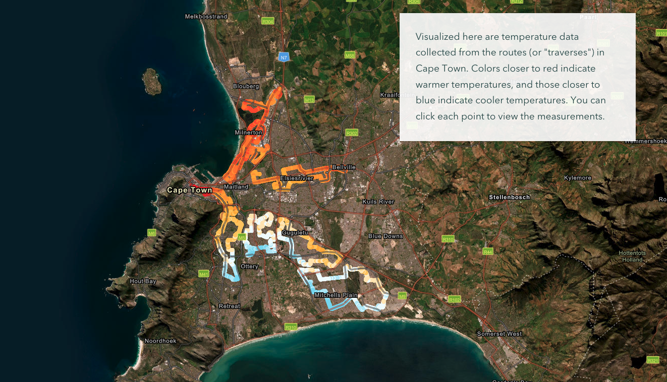
100+ heat hotspots identified
through 2024 mobile-sensor mapping
Up to 7–10°C
temperature differences mapped between neighbourhoods
Multiple new cooling centres
established in vulnerable communities
Thousands of trees planted
under the expanded urban-greening programme
City-wide SOPs
(Standard Operating Procedures) now protect residents during heatwave emergencies
High-resolution ArcGIS StoryMap
makes heat data accessible to all residents
Comments ()